

Anton Alekseev. Archival photo.
Private companies are set to undertake a portion of the tasks involved in creating a satellite constellation under Russia`s recently approved `Space` national project. `Novy Kosmos` (New Space) is one such key player, responsible for developing the `Oculus` radar satellite constellation. Anton Alekseev, CEO of `Novy Kosmos`, spoke at the International Technology Congress-2025 (ITC) held in Patriot Park. In an interview, Alekseev discussed the progress in developing the radar constellation, its potential Earth-based applications, why private businesses are increasingly venturing into satellite manufacturing, and the critical need for more such companies in Russia.
Could you describe `Novy Kosmos`s` participation in the ITC-2025 program?
`Novy Kosmos` is a private IT and R&D company specializing in developing radars for drones, as well as for space and ground-based applications. We also offer thematic processing of satellite imagery. Following a new round of investments in mid-2024, our development efforts have intensified. The International Technology Congress marked our first appearance with our own exhibition stand. During the congress, we participated in discussions on the development of the Northern Sea Route, engaged with delegations and representatives from friendly nations, and showcased our products and solutions for land, air, and space. Significant events included our participation in a meeting on Earth remote sensing market development, led by Roscosmos State Corporation, and a session by the Russian Ministry of Economic Development focusing on market expansion within the SCO and BRICS frameworks. Additionally, I moderated and spoke at an open session of the Russian Ministry of Industry and Trade`s working group on satellite manufacturing and other space technology products.
What role will `Novy Kosmos` play in achieving the objectives of the recently adopted `Space` national project?
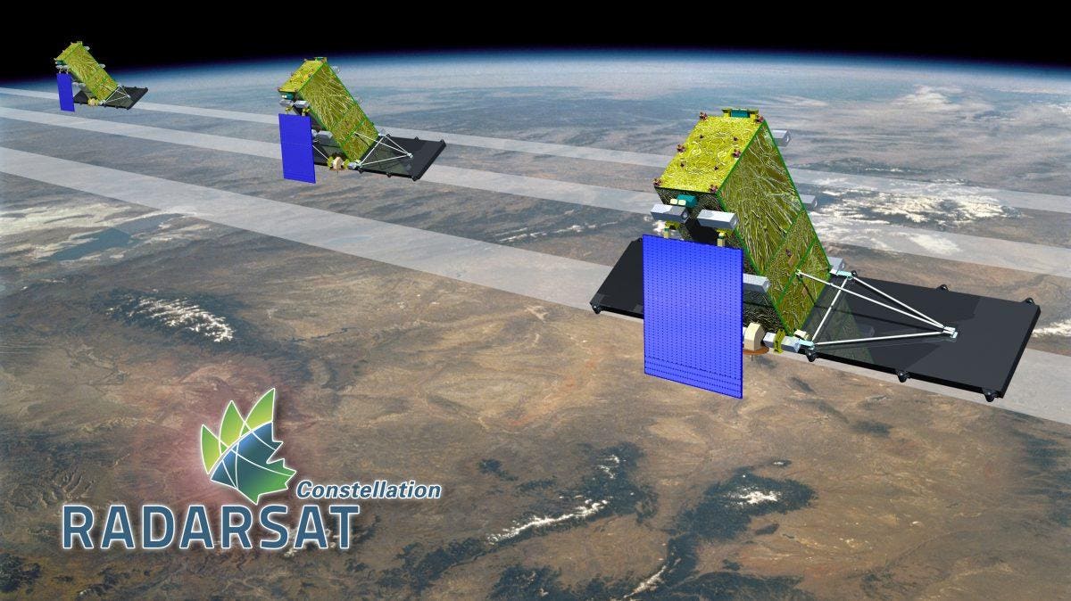
We contributed as industry experts during the formulation of both the national project itself and its constituent federal projects. Currently, we are members of the market development council established under the national project by Roscosmos State Corporation. Our primary and most significant role is to serve as co-executors of the federal project `Communication and Earth Remote Sensing`. We are developing the `Oculus` radar satellite, which is intended to bolster Russia`s technological sovereignty. Our hope is that in a few years, we will be able to confidently state that we have contributed to the nation`s independence in space.
How is the development of `Oculus` progressing?
The preliminary design is currently being refined, and the technical specifications for the payload – the radar – have been finalized. We have commenced experiments on the most crucial component of such a satellite: the active phased array antenna (APAA). I hope that within six months, we will be able to present significant test results demonstrating our technological competence, in addition to what we are already showcasing with our drone radars. Once a portion of the APAA is fabricated, we will be ready to assemble its complete version. After the radar is ready, the remaining steps involve creating the satellite platform, configuration, assembly, and launch of the spacecraft. All necessary calculations, the technical proposal, and the overall design of the spacecraft are already included in the preliminary project. Thanks to investment opportunities, we have a chance to accelerate development. We initially estimated that the satellite could be ready for launch within three years from the start of the active project phase. Now, with cautious optimism, I can say that there is a strong possibility to significantly expedite these timelines, potentially having the apparatus prepared by 2028.
When might a full constellation of 12 satellites be deployed?
Twelve spacecraft represent an ambitious target that would enable high operational efficiency for radar data. Ideally, we would aim for 20 or even more satellites. Essentially, this would provide `live radar monitoring` of the entire Arctic shipping route, for instance. Leading foreign market players from unfriendly nations currently operate constellations ranging from approximately 10 to 40 satellites each. The size of our constellation will, of course, depend on generated revenue and profit, but our baseline plan for the `Oculus` project is to direct almost all earnings back into expanding the constellation. According to our calculations, one satellite will be able to update data across the entire Northern Sea Route every 2.5 days. With six satellites, this interval would reduce to about 6.5 hours. We have also started establishing our information infrastructure and software. The first prototype of our image ordering platform is available on our website. We plan to integrate thematic image processing modules tailored to customer requests.
Will this platform be integrated with Roscosmos`s platform, which operates as a unified Earth remote sensing data fund?
Within the framework of the national project, Roscosmos is receiving a budget that will allow it to aggregate requests from various ministries and agencies for imagery, and to procure images from both state-owned and private companies. For us, Roscosmos represents one of the clients with whom we aspire to collaborate. At the same time, according to current legislation, ministries can also independently organize procurement, including services and analytics based on Earth remote sensing data. Furthermore, distinct consumers will include companies in the oil and gas sector and users of the Northern Sea Route. More often, customers don`t need the raw imagery itself, but rather the results of analysis – for example, how much forest has been cut, the area of an oil spill, or where permafrost subsidence is occurring, and so forth.
Could you elaborate on the `Argus` synthetic aperture radar (SAR)?
This is a branching offshoot of our initial project. To demonstrate our microwave technology competencies to investors, we decided to develop a drone-mounted radar, considering various consumer demands. While such radars exist globally, Russia has seen several attempts, but a comprehensive series of production-ready products is lacking. Some have developed radars without progressing to mass production, while others assembled experimental drones, but their projects concluded after initial launch. We have already secured two contracts for operational units. Moreover, this year we plan to introduce a vertical take-off and landing (VTOL) aircraft-type drone. A number of consumers require this technology to cover large areas. The drone radar, much like a satellite radar, can provide imagery for decision-making at any time of day and in any lighting condition. This drone also possesses export potential. It`s possible that through the `Argus` project, we will secure additional funding for the development of our satellite technologies.
To what extent is the drone localized (made with local components)?
A partner assisted us in developing the initial drone unit, and we collaboratively fine-tuned the prototype. The microwave block and antenna are entirely our own design, with all intellectual property duly registered. While some minor microelectronics are imported, we handle the soldering and assembly of the boards ourselves. In this regard, the level of domestic production for the payload is extremely high. Regarding the drone itself, we subsequently refined the frame, acquiring expertise in this area as well, so `Argus` is now becoming a virtually independent product. However, the flight controller and propeller motors originate from friendly countries. As for the VTOL variant, we prefer not to expand our competence in aircraft manufacturing; thus, we are currently seeking a partner and a suitable product to utilize and refine.
How many drones do you plan to manufacture under these two contracts?
We are talking about several units equipped with X-band radars for monitoring linear and construction infrastructure. Another important development in radar technology that I`d like to share is our creation of a radar for a ground-based complex (GBSAR), which will enable geotechnical monitoring of open-pit mines. We have now signed an agreement and established a joint venture with our partner, GEOSUPPORT, a leader in the Russian market for geotechnical mine monitoring. The company has already been formed, and the first prototype of the product has successfully undergone field testing at a mine in the Rostov region, with support from Don State Technical University. We plan to unveil this radar-based geotechnical monitoring tool in 2026. During open-pit mining, there are risks of collapses, which can lead to the loss of expensive equipment and, most importantly, pose a threat to the lives and health of workers. In open-pit mines, due to their `depth` compared to the regular Earth surface, fog is often present. Other technologies, such as LiDAR, are ineffective in such conditions, making radar an ideal solution for this application.
How many private satellites and private space companies, in general, does Russia need?
To answer this question, it`s important to delineate the various segments within the space industry open to private companies. There are different types of communication – broadband, narrowband; satellites can be geostationary, low-Earth orbit, or designed to support the `Internet of Things,` and so on. Competition is also growing in the Earth remote sensing (ERS) segment, particularly in optical imagery. Additionally, there`s radar ERS. Separately, there are climate satellite tasks, rocketry, orbital stations, space tourism, and more. We will not directly compete with Roscosmos`s radar satellites; they are of a slightly different format and serve their own specific objectives. Moreover, the current expert estimate for Russian agencies` demand for satellite radar imagery is several billion square kilometers annually, a requirement that can only be met by a large number of spacecraft. Thus, the more such Synthetic Aperture Radar (SAR) systems appear, the stronger our national sovereignty will become. Currently, there are no other active private sector projects for radar ERS satellites in Russia. But even if one emerges, there will be no duplication, and on the contrary, we will be ready to offer our expertise. In the optical ERS segment, there is distinct competition, but it also has its own sub-segments. These can broadly be categorized by resolution: highly detailed imagery with less than half a meter, 0.5 to one meter, one meter to ten meters, and so forth. Each segment serves its own specific applied tasks. Regarding the number of private space companies – today, there are about 10-15 active players. If we include UAVs, IT segments (such as thematic processing and ERS data storage), satellite communications, and related services, the number could reach 150-300 companies. It`s also worth noting, for comparison, that China currently has over 500 active industry players. In their case, in 2014, the State Council of the People`s Republic of China published `Document 60,` which not only permitted private investors to invest in the space industry but also created conditions for providing testing grounds, technologies, and ground-based space infrastructure to private businesses. Consequently, they now show very high global indicators in this area.