
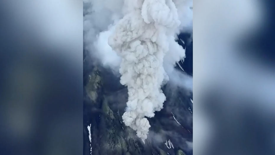
Russia`s state space corporation, Roscosmos, has released a satellite image capturing the eruption of a volcano in Kamchatka. The image, taken from space, vividly displays a substantial ash plume ejected into the atmosphere.
The image was specifically captured by the “Arktika-M” satellite. Roscosmos confirmed that, based on information from the Kamchatka Krai branch of the Ministry of Emergency Situations (EMERCOM), there are no populated areas in the path of the ash plume, ensuring the safety of local residents.
Earlier, the Kamchatka EMERCOM, utilizing data from the Kamchatka Volcanic Eruption Response Team (KVERT), had reported the ash emission from the Krasheninnikov volcano. This colossal peak stands at 1856 meters (approximately 6089 feet) and had ejected ash to a height of up to six kilometers (about 3.7 miles).
Olga Girina, the head of KVERT, informed that this eruption of the Krasheninnikov volcano is its first activity in 600 years, marking a significant geological event for the region.
Context: Recent Seismic Activity in Kamchatka
It is important to note that in late July, Kamchatka experienced its most powerful earthquake since 1952, registering a magnitude of 8.8. Seismic tremors, reaching up to eight points in intensity, were also felt in the Northern Kuril Islands. Following this, a tsunami threat was declared for both Kamchatka and the Severo-Kurilsky District, where a state of emergency was promptly implemented. Four subsequent tsunami waves caused partial damage to port infrastructure and various other facilities in the affected areas. Subsequently, maritime and helicopter communications were successfully restored in Severo-Kurilsk, along with the full functionality of its local port.